


Voting District 0813400001012, Kent County, Michigan
About
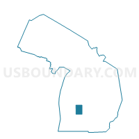
Outline

Summary
| Unique Area Identifier | 597258 |
| Name | Voting District 0813400001012 |
| County | Kent County |
| State | Michigan |
| Area (square miles) | 0.15 |
| Land Area (square miles) | 0.15 |
| Water Area (square miles) | 0.00 |
| % of Land Area | 100.00 |
| % of Water Area | 0.00 |
| Latitude of the Internal Point | 42.97604470 |
| Longtitude of the Internal Point | -85.69067120 |
Maps


Graphs
Select a template below for downloading or customizing gragh for Voting District 0813400001012, Kent County, Michigan


Neighbors
Neighoring Voting District (by Name) Neighboring Voting District on the Map
- Voting District 0813400001010, Kent County, MI
- Voting District 0813400001013, Kent County, MI
- Voting District 0813400001017, Kent County, MI